A fond farewell

Dear WonderingAroundOregon readers:

After three years of wandering and wondering around Oregon, and falling in love with it over and over again at every turn, my time here has come to an end (for now). We’ve moved across the country where we are needed right now, helping family and learning how to be more compassionate and caring people to those we love. I’ve traded basalt and Douglas fir lined hiking trails for quartz and red clay paths shaded by oak-hickory forests.

quartz on trail
Quartz rocks on the trail in NC

So, sadly, I will not be posting any more Wondering posts for awhile. But before I go…

I do want to express my deepest condolences for the loss of forests, life, and property that occurred recently as a result of our beloved Columbia River Gorge being set on fire. I am glad I wasn’t there to witness it, but I feel the pain and suffering, just as all of you – the collective lovers and caretakers of Oregon’s wild places – do for the loss of beauty and life. Take solace in knowing that nature is incredibly resilient, and she will come back, in some form that none of us can even begin to predict. Understand that our human time scale and the havoc we seem hell-bent on ravaging upon the land is just a tiny blip in the screen of time and space. This earth will remain, will evolve, will carry on. Nature will always bat last.

I’ve only been back in the south for a month but have already picked muscadine and scuppernong grapes and made jam, as well as – in my grandmother’s words – “put up a mess of” pickled okra. So, I guess I’m re-embracing my southern food roots. I’m eager to explore the woods and wilds here in North Carolina once again,too, and I expect some of that will end up on a blog eventually.

Even though I will not be posting here, I will check and respond to comments and would love to hear from you as you keep exploring Oregon. I invite you to pop over to my Endless Seeker blog, where I will continue to post my #LiveWell2017 series through the end of this year and then, who knows…

So long, Oregon.

Until we meet again…keep wandering and wondering around Oregon.

All my best!

Fireweed: a summer beauty

IMG_3361
Fireweed. Photo by Marvin Kellar

It is the middle of summer in the Pacific northwest and the fireweed (Chamerion angustifolium) is blooming everywhere. I’m seeing it all over Mt. Hood National Forest, near Mt. St. Helens, and along the Springwater Corridor in Portland and Gresham. A month ago it was just beginning to bloom in Alaska. Fireweed is a pioneer plant, one of the first to establish itself in disturbed soils – often along paths, roadsides, and anywhere a fire has burned (hence the name). It can grow to an impressive height of nine feet, but it is more commonly seen up to six feet high. It’s green leaves are long and narrow with unique circular leaf veins. The roots connect and form large colonies of fireweed. Rarely will you see a single plant growing by itself.

Fireweed’s pink-purple flowers are the star of the show. They bloom in a spike at the end of its stem, often with as many as 50 papery thin pink flowers. The flowers bloom from the bottom of the spike to the top. In Alaska, fireweed is an indicator of the coming of winter. Once the top flowers bloom, the first snow is likely less than 30 days away. Once the blooms are spent, they produce a capsule filled with fluffy white seeds. One fireweed plant can produce as many as 80,000 seeds.

fireweed1
Fireweed flowers. Photo by Marvin Kellar

Fireweed is edible and a favorite of many foragers. It’s leaves and shoots are high in Vitamin A and C. Leaves can be used to make tea and early shoots can be eaten raw or lightly cooked as a tangy spring vegetable. Fireweed nectar is used to make honey and syrup. It has been used as a traditional medicine, too. It has anti-inflammatory properties and has been used to aid in digestive disorders, sore throats and congested lungs.

fireweed flower stalk
Fireweed flowers bloom from bottom to top of the spike. Photo by Deb Hanson

It was one of the very first plants to return to the soil after Mt. St. Helens erupted in 1980.

dwarf fireweed
On the glaciers of Alaska, a dwarf fireweed grows in the glacial silt. (Photo by Deb Hanson)


We rode part of Oregon’s newest scenic bikeway

Oregon has a new scenic bikeway.

20170710_104604

One of the things that sets Oregon apart from other states is that it is the only state in the union that has designated scenic bikeways – not just one or two, but sixteen of them! The newest one is the Sherar’s Falls Scenic Bikeway near Maupin, OR. Yesterday, we rode the flattest section (17 miles out and back) of the 33.4 mile loop, along the Deschutes River.

20170710_112111
A calm section of the lower Deschutes River known as the Blue Hole

The Sherar’s Scenic Bikeway is considered a moderately challenging loop because there are some extended climbs, though not killer, and it is located in high desert canyon country, which can be hot in summer. Being summer and the lazy, old folks that we are, we chose to bike only the relatively flat section along the federally designated Wild and Scenic Deschutes River.

20170710_120220
Warm Springs tribal fishing platforms


We started at Sherar’s Falls which is located on Warm Springs Tribal lands. It is the last falls of the Deschutes before it meets the Columbia River 44 miles north. Warm Springs tribal members use the falls area to fish for salmon by standing on wooden platforms that extend out over the rapidly churning river. From there, the bikeway is along a BLM Access Road that hugs the river all the way into the small town of Maupin (pop. 423). (By the way, you can park in designated parking areas along the access road with your NW Forest Pass or other federal pass or day use pass for $5. We did’t drive that far before we parked, and ended up paying $10 each to the Warm Springs Tribe to park in their day use area by the falls. I don’t mind supporting the tribe, but if you want to save some bucks, park on the BLM Access road)

20170710_120226
Sherar’s Falls and fish ladder on the Deschutes

The scenery is dramatic. High canyon walls of basalt and boulder cobble rise above the river at sometimes steep angles. Trees are scarce except in patches along the river edge. Sagebrush dominates the desert hills that have soil and adds a sweet aroma to the clean, clear air.

20170710_104201
Basalt canyon walls
20170710_105827
Sagebrush

The day was clear and warm. Before we had biked a mile, we spotted a bald eagle perched high on a basalt column looking for fish in the river below. Crickets chirped. Golden eagles and turkey vultures soared overhead. While scanning the cliffs for eagles and sheep, Keith spotted a mule deer tucked under the shade of a lone tree across the river.

20170710_110131
Look close and you’ll see a mule deer resting in the shade of a juniper along the Deschutes River

It was a beautiful day to be on the water and the river rafters were abundant. We saw several groups of floaters enjoying the swift flow of water, including three sets of Outward Bound boats loaded with camping gear and teenagers. The section of the Deschutes between Warm Springs and Sherar’s Falls is the most heavily rafted section of the river.

20170710_100928-EFFECTS
River rafters float by the old grain elevator in Maupin, OR

As we approached the town of Maupin, big, beautiful houses clung to the canyon walls and an old grain elevator gave a hint of the agricultural influence in the area. The bikeway loop is surrounded in almost every direction by wheat fields.

20170710_082418
Wheat fields near Tygh Valley and Maupin, with Mt. Hood in the distance

We stopped at Maupin City Park to eat our snack and watch the rafts launch. The tiny town of Maupin perches several hundred feet above the river. It seemed like 80% of the businesses were rafting outfitters. It has a cute, walkable main street decorated with hanging baskets of flowers.

The ride was easy, in spite of some headwinds going toward Maupin. In fact, we couldn’t believe we got there so fast. So, on our way back downstream we stopped to investigate some of the day use areas and soak in the scenery. It was a a beautiful, easy ride. Maybe next time we’ll do the whole 33!

20170710_115727

Have you biked this scenic bikeway yet? What did you think?


10 reasons you should stay and eat at the historic Frenchglen Hotel

DSCN8120

For any nature lover, the wonders of the Steens Mountain, Alvord Desert, and Malheur National Wildlife Refuge are the big draws to Harney County, Oregon, but a stopover at the historic Frenchglen Hotel is a must-do while you’re there! The Historic Frenchglen Hotel is both a hotel and a state historic site. It opened as a hostelry in 1916, built by the Swift & Company Meat Packers to accommodate people who came to the area to do business with them and area ranchers. A newer building was built in 1924. It was purchased by the US government as part of the Peter French P Ranch and Malheur Wildlife Refuge complex. The Oregon State Parks purchased the hotel from the US government in 1972 to preserve it as a historic heritage site.

DSCN8121

We stayed at the hotel on our recent visit to the Steens because it was on our Oregon bucket list. We had a wonderful time there. Here are our top 10 reasons why you should add it to your bucket list, too!

  1. It’s a step back in time. Not just because the hotel was built in 1926 and renovated in 1938, but because your host greets you by name, you sign in on hand-written guest cards, there’s a hand-made quilt on every bed, and there are no room keys, just a lot of trust and old-fashioned hospitality.
  2. You can unplug. There are no televisions or telephones in the rustic, cozy rooms, and cell phone coverage is spotty. Staying here gives you a chance to unplug and unwind from the digital barrage of daily life. Take advantage and enjoy the silence.
  3. John Ross cooks up a magnificent family style dinner! John Ross has been the proprietor at the Frenchglen Hotel since 1991. He cooks up every meal by hand every single day. Dinners are served family style precisely at 6:30 PM (don’t be late!) at picnic tables inside the cozy hotel lobby. The food is down-home and delicious – mashed potatoes, spinach & artichoke casserole, baked chicken, roast beef, fresh salads, breads and…
  4. Apple cake with ice cream and caramel sauce. Yes, dessert is a highlight. Even after eating too much dinner, everyone partakes in the sweet, scrumptious freshly made dessert of the day. He served apple cake one night and peach cobbler the next. I hear that marionberry pie is a favorite in the summertime.
  5. You’ll meet interesting people from all over. Those family style dinners in close quarters pretty much force you to socialize with whoever else shows up for dinner. They may include hotel guests, nearby campers, and sometimes even a local or two. On the two nights we were there we met folks from Buffalo, NY, Redmond, OR, Tuscon, AZ, Spokane, WA, Idaho, California, and The Netherlands. We learned about their lives and adventures and shared stories of travel and exploration.
  6. It will bring back memories of your childhood. Remember when your brother was hogging the bathroom and you couldn’t get in? Bathrooms are shared here. There’s a men’s room and a ladies room upstairs, shared by all the guests in the eight quaint bedrooms down the hall. If the bathroom is occupied, there is an extra one downstairs. If that one’s also occupied you can always use the public outhouse in the side yard!
  7. You can get breakfast or lunch to go. Remember, you’re in the middle of nowhere here. Restaurants are 30, 40, 60 miles apart. If you want to get an early start exploring the area or plan to be out all day, hiking or biking or bird-watching, you can get some tasty scones and coffee or a sandwich and chips to go – no need to wait for breakfast to be served at 7:30 or to return to the hotel for lunch.
  8.  No traffic, traffic lights (or even stop signs). Frenchglen has a population of 12. That means it’s tiny. I can stand in front of the hotel on one end of “town” and throw a rock to the other end. So, the only sounds you hear are the birds and the wind. Cars and trucks are scarce, even at the height of tourist season. There’s a two-room schoolhouse and a general store. Bring what you need with you.
  9. There’s a wildlife refuge out the front door. Yes, Malheur Wildlife Refuge stretches all the way down to Frenchglen and just across the street from the hotel is a trail, a wetland, and interpretive signs. We enjoyed the sounds of sandhill cranes and watched birds, marmots, ground squirrels, and deer each day. Of course, it was also late spring and the mosquitoes were abundant and hungry.
  10. Steens Mountain looms large in the east. You can sit on the front porch of the Frenchglen at sunset, sipping a glass of wine or a cup of tea, and watch the sun light up the magnificent snow-capped Steens just 22 miles to the east (as the crow flies).

Have you stayed at the Frenchglen Hotel? What was your experience?

This slideshow requires JavaScript.


Belding’s ground squirrel

On our trip to southeastern Oregon’s high desert last week, we were astounded at the number of mammal species we encountered in just four days – pronghorns, deer, marmots, voles, squirrels, horses, cattle, jack-rabbits. One of the most abundant mammals in eastern Oregon is the Belding’s ground squirrel (AKA sage rat).

DSCN8299

Just in the small area around of the historic Frenchglen Hotel, I saw at least a dozen Belding’s ground squirrels. They would emerge from their numerous burrows just after sunrise and stay active until sunset – feeding, chasing each other, and peering around for predators. As we drove along Hwy 205, both north and south of Frenchglen, a ground squirrel ran across the road about every 5 seconds.

They are relatively small ground squirrels, measuring only 8.5 inches long with a short 2.5-inch tail and small ears. They have few markings and are generally brownish-gray to red in color. Their burrows extend about two feet below ground.

DSCN8133

Belding’s ground squirrels are seasonal rodents. They hibernate for nearly seven months of the year, starting in August, but when they emerge in late spring, they are eating machines. They do not cache food for hibernation, so they must double their weight by eating during the spring and summer. Preferring leaves and stems of wild and cultivated grasses and roots of other herbaceous plants, Belding’s can do considerable damage to yards and agricultural crops in a short time.

DSCN8129

In fact, Belding’s ground squirrels are the most damaging ground squirrel to agricultural crops in California and eastern Oregon. Not only do they damage crops, but they can chew through irrigation lines, weaken levees and ditches with their burrows, and pose hazards for farm workers and equipment. Because of that, farmers and ranchers spend a lot of time and money trying to manage them using methods as diverse as fumigation, trapping, shooting, toxic baits, and burrow modification. Baiting with poison-coated seed is not effective since Belding’s ground squirrels are not typically seed-eaters.

Cute as they are, these ground squirrels (like many desert rodent species) can be deadly. They spread diseases such as Rocky Mountain spotted fever, rat bite fever, tularemia, Chagas’ disease, adiospiromycosis, and encephalomycarditis. They also serve as reservoirs for bubonic plague (which spreads by fleas from infected squirrels). So, it’s best to observe them from a distance.

Oregon Badlands Wilderness Area

badlands and buckwheat
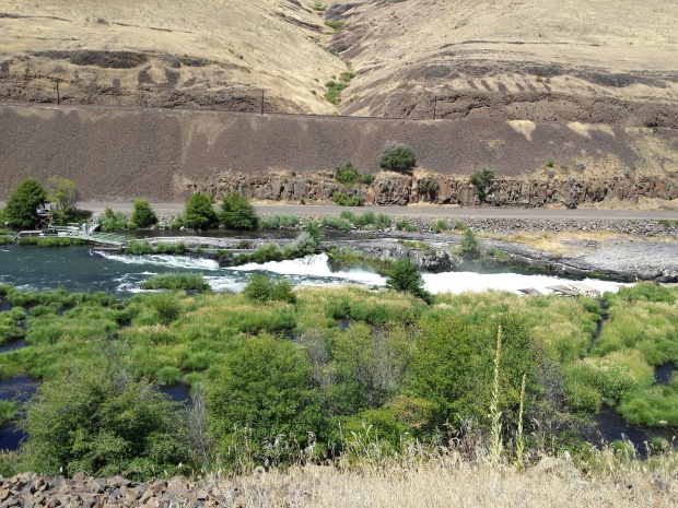
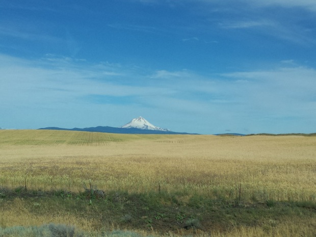
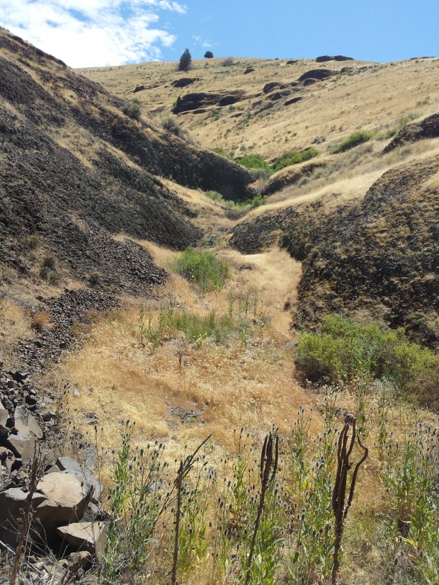
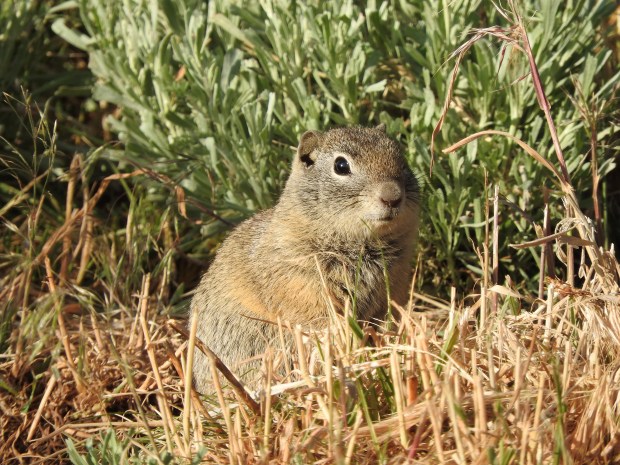
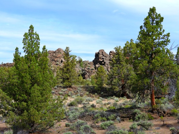
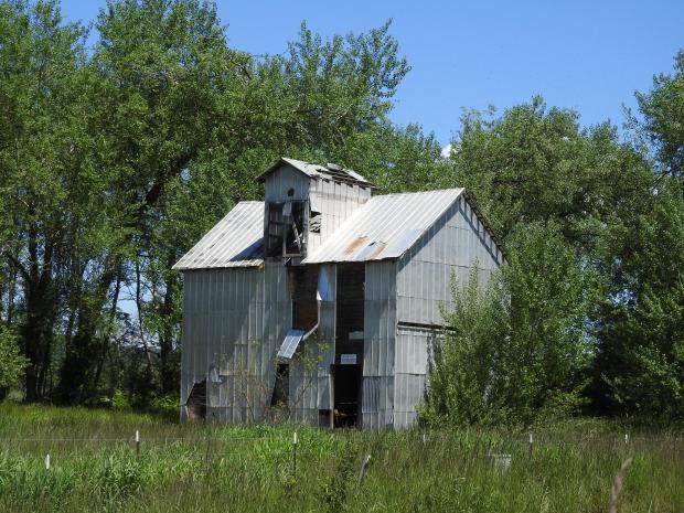
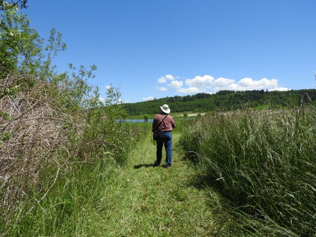
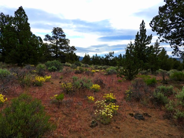
This is the first in a series of posts from our recent trip to central and southeastern Oregon. I’d been wanting to hike the Oregon Badlands Wilderness Area for some time, but it seemed like we were always in the Bend area during the hottest of summer months, and hiking the desert in 98-degree weather was not at the top of my wish list.

This time was different. On our way east to Steens Mountain in early June, the weather was perfect – a cool 50-degrees, light breeze, partly cloudy – so, we stopped to hike six miles on the Badlands Rock Trail.

gate to badlands trail
Gate at entrance to Badlands Rock Trail

As our feet crunched along the sandy trail of volcanic ash and eroded lava, we admired the sagebrush and juniper landscape dotted with bright, hardy, spring desert wildflowers. Meadowlarks called incessantly, but hid successfully in plain sight. Insects buzzed among the foliage. Distant mountains cast a purple hue on the horizon.

badlands and hills

The Oregon Badlands formed from a lava flow that originated up the Newberry volcano about 80,000 years ago. A lava tube developed a hole in its roof, allowing lava to flow upward and outward in all directions, forming what is now known as the Badlands shield volcano. The soils are mainly ash that came from the eruption of Mt. Mazama which made Crater Lake 7,700 years ago.

keith on badlands trail

The plants and animals that inhabit the Badlands must adapt to desert conditions with less than 12 inches of rain a year. We saw many species of wildflowers:

The star of the Badlands Rock Trail is, of course, Badlands Rock at the 3-mile mark.

badlands rock
Badlands Rock

We noticed that many of the larger junipers were growing out of rock formations. It appears they find suitable niches of soil and water in the cracks and crevices of the volcanic basalt.

juniper rock

It was a fabulous hike on easy terrain, but arid and open. The wide sky and distant hills drew our gazes upward, while the unique volcanic rock formations, desert flowers and small critters gave us plenty to see on the ground. Other trails lead to unique features including “Castle Rock”, “Flatiron Rock”, ancient juniper trees, craters, and caves. We returned on the same trail this time so we could head further east and south for more desert adventures, but we will return someday.


The Oregon Badlands was designated a federal wilderness area by Congress and President Barack Obama in 2009. The 29,180-acre wilderness has about 50 miles of trails for hiking and horseback riding. Many are unmarked so use of a map and compass are essential.

Farewell-to-spring (Clarkia amoena)

farewelltospring1
Clarkia amoena (Photo by Deb Hanson 2017)

Farewell-to-spring (Clarkia amoena) is a melancholy name for this perky, pink native Oregon wildflower. I saw them recently on a hike to Dog Mountain in the Columbia River Gorge. They were scattered along the lower elevations of both the Dog Mountain and the Augspuger Trails. I noticed they were especially abundant on patches of dry, rock-strewn slopes among patches of dead grass.

The bright pink spots in the center of each petal is what caught my attention. The flowers can range from pale pink to deep wine red in color, but always have a patch of darker pink on each of the four petals. The flowers are generally single, and less than 1-1/2 inches wide. The stems are gray-green and slender with slim, lanceolate leaves. Eight stamens curl up around the single pistil in the flower’s center. The plants I saw were about a foot tall.

farewelltospring2
Farewell-to-spring (Photo by Deb Hanson 2017)

This flower’s genus name (Clarkia) comes from Captain William Clark (of Lewis & Clark). It’s species name (amoena) means charming or pleasing. Certainly, it is. Other common names are herald of summer or summer’s darling, which surely describes the time of year you are likely to see it in bloom.

The flowers serve as a source of nectar for important polinators such as honeybees, mason bees, bumblebees, butterflies, and other benficial insects. I saw many small insects and bees among them at Dog Mountain.


A Baskett of wild surprises

DSCN7712

“Stop!,” I yelled as we slowly drove west on Coville Road. “There’s something in the field.” I rolled down my window and peered through binoculars to find a silver-feathered male Northern Harrier sitting on a hump of plowed farm dirt, preening. I sat there for a few minutes admiring his pale beauty in the bright Oregon sunshine. I’ve seen harriers in flight many times, but never had the luxury to watch one perched and preening for so long.

It was a gorgeous, sunny, unusually warm, spring day, and we were going for a hike at Baskett Slough National Wildlife Refuge west of Salem. The harrier proved to be only our first surprise. As we hiked up to the top of Baskett Butte and out to the Rich Guadagno observation platform, we learned through interpretive signs that the butte trail was dedicated to Rich Guadagno, a former refuge manager who died in the United Flight 93 plane crash on 9/11. He was 38 years old. It was a poignant and touching tribute to a man who obviously loved nature and nurtured this land where we now stood.

DSCN7714


The views from Baskett Butte are inspiring – surrounding farm fields, the peak of Mt. Jefferson, and beautiful old growth oak savannas (one of the most endangered habitats in Oregon).

DSCN7720

On this day in May, wildflowers dotted the meadows – Oregon sunshine, lupine, Nootka rose, Mariposa lilies and more.

mariposa lily.jpg
Mariposa lily (Cat’s ear)


Near Morgan Lake at the north end of the refuge, we saw a large area of white, and wondered if it was bare sand. A look with binoculars showed us it was a wildflower bloom, solid white and expansive. We were able to hike around the edge of the lake and get a closer look. Turns out it was a field of white meadowfoam (Limnanthes alba). Turns out, one species of meadowfoam is an important commercial crop in the Willamette Valley. The seed oil is used in cosmetics.

This slideshow requires JavaScript.

At one point along our hike, as we emerged from the oak savanna and walked downhill toward the marshes to the north, Keith wondered aloud if ring-necked pheasants lived here. Five minutes later we flushed a pheasant from the tall grass and watched it glide about 200 yards across the meadow to a copse of bushes. Pheasants are an introduced, naturalized species in the US. In fact, they were first introduced in the Willamette Valley from China in 1882. Farmland habitat is a pheasant’s heaven, so it makes sense that they would be sighted here at the edge of farm and refuge.

DSCN7726

As we crossed Moffitti Marsh along the freshly mowed but sometimes muddy trail, we spotted nesting tree swallows in their iridescent blues, striking yellow common goldfinches, cinnamon teal, and red-winged blackbirds.

dscn7757.jpg
Tree swallow
goldfinsh.jpg
Goldfinch

There was even a swarm of bees circling around an old barn across the road from the marsh. Hiking back up the butte from Morgan Lake we spotted three black-tailed deer browsing at the edge of the forest.

DSCN7778DSCN7781

Four hours after we had seen that harrier stting and preening in the field, we left Baskett Slough National Wildlife Refuge with a renewed sense of wonder and light hearts. Our five miles of hiking had provided surprise after surprise, each one marvelous and welcome. Thank you to the US Fish and WIldlife Service for managing yet another amazing natural area for the people!

If you go: Baskett Slough NWR is located off of SR 22, west of 99W and Salem, OR. Some trails are closed in winter to protect wintering waterfowl. Take sun protection in summer; most of the trails are not shaded.


Oregon’s feathered camp robbers

Gray jay
Gray jay (photo ©Deb Hanson 2017)

Gray jays are one of the most entertaining birds of the Pacific Northwest. They have earned the nickname “camp robbers” because they are quite adept at sneaking into campsites and cabins (and flying onto hikers’ hands!) to steal food.

These little gray jays are cute and sneaky, but they are tough little critters, too! They live in very cold climates (think northern Canada and Alaska, as well as the Cascade and Rocky Mountain ranges), rarely migrating out of high elevations or south. They can do that because they store food in the bark of trees (using sticky saliva to keep it there) all summer, so they have plenty to eat during the winter.

Their diet is varied. They will catch insects in flight, eat seeds and nuts, attack rodents and birds, and eat carrion (left by wolves or other predators) in winter.

gray jay face
Gray jay (photo ©Deb Hanson 2017)

These little birds are so tough they even nest and raise their young during the late winter and early spring rather than wait for warm summer days like most other songbirds. Typically they lay 3 or 4 eggs. Mom incubates them for 20 or so days while dad feeds her. After hatching, parents take turns feeding the young. They leave the nest at about 24 days, then hang around for parental guidance for another 30 days before they fly off to live their own lives.

We’ve seen them at Mirror Lake near Mt. Hood, begging food. Friends of ours had them land right on their hands eating gorp while they were out snowshoeing at Trillium Lake one day this winter. They make a lot of different sounds, from whistles to harsh, scolding cries. If you are up in the mountains here in the Oregon, be on the lookout for these cute little “camp robbers.”

gray jay with nut
Gray jay with nut (photo ©Deb Hanson 2017)


Pacific poison oak: hiker’s scourge

What is it?

Anyone who has done much hiking in Oregon has seen this plant, even if they didn’t know what it was. Pacific poison oak (Toxicodendron diversilobum) is common in sunny and partially shaded areas and on rocky, south-facing slopes, especially in the eastern Columbia River Gorge and on Willamette Valley’s oak savannas. I’ve seen it on the edges of Doug fir forests and mixed deciduous forests as well, though. As long as the soil is acidic and below about 4000 feet, poison oak can grow there.

As someone who moved from the east, where I sported a patch of poison ivy rash somewhere on my body most of the time, I learned to identify poison oak as soon as I moved to Oregon. Like poison ivy, it typically has three leaves (you know, “leaves of three, let it be”), but sometimes five. Pacific poison oak can grow as a shrub, a trailing vine or a climbing vine. It’s leaves look very much like Oregon oak leaves, but not as deeply lobed. In the spring it is bright green, but in fall turns a brilliant shade of red.

poison oak

There are some great photos of its many variations here.

I’ve been lucky to avoid contact with it until now. Last week, I was in the Gorge shooting photos of wildflowers, and wasn’t careful to look for the new leafless shoots of poison oak popping up in springtime. I guess my sleeves must have grazed some shoots when I was down on my knees taking pictures, because two days later I began to feel an itch on my wrist. The next day it had bubbled up, and by the fourth day it turned yellow. I had my first full-blown case of Pacific poison oak.

The rash

20170404_100256
Poison oak rash

Lovely, isn’t it? Like its eastern cousin, poison ivy, Pacific poison oak has an oil called urushiol. It’s on every part of the plant and is active as long as five years after the plant is dead! That’s potent stuff. If you don’t wash it off with soap and water (or neutralize it with Tecnu) within 15 minutes of exposure, the urushiol bonds to your skin and then your immune system kicks in, causing the rash and bubbles and fun. It appears my rash is limited to my wrist and a finger or two, so I’m not worried about it, but there are folks who get much more serious rashes and need medical attention.

It’s not a “bad” plant

In spite of Pacific poison oak’s irritation to us human hikers, it has some redeeming qualities. It is a good food source for animals like deer (which browse leaves and stems) and birds (which eat the berries). The young leaves are high in protein and are sometimes food for goats. I actually found an article suggesting that it be “strategically planted” in a garden or yard for bird food. I’m gonna say no to that one.

Poison oak stands are also used as nesting sites by a federally endangered bird called the Bell’s vireo, and a rare colony of ringtail has been found nesting in a cottonwood-poison oak woodland near the Sacramento River in California. It might surprise you to know that Pacific poison oak is the most wide-spread shrub in all of California (source: US Forest Service). Wow!

Here are ten myths about poison oak busted by the WyEast blog.

Now, you know 🙂